 |
 |
 |
 |
||||
|
|
|
|
|
|
|
|
|
|
|
|||||||
|
|
|
|
|
|
|
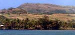
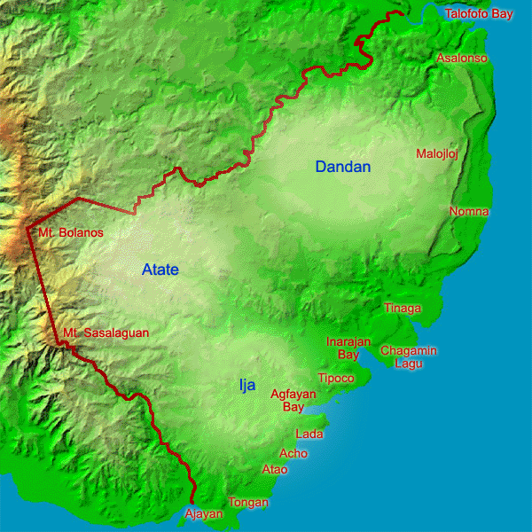
Inarajan comprises a large area of Southern Guam, reaching from the mountains to the sea and having several stream systems. Rufo Lujan gives us a tour of place names and areas that comprise this municipality. "The use of place names for the different areas is as a locator. It makes it easier when you talk to somebody, and they're trying to describe a place or a region, then it makes it easier to visualize where that place is. When I say, 'It's in Atate,' you have a general idea of the area that I'm talking about."
|
||
|
|
||
Coastal Names: “Let’s say you’re traveling on the road from Talofofo. As soon as you cross the Talofofo River, when you climb that hill and come to the next river, that area is called As-Alonso. And then when you cross the river and climb up the hill, you’re into Malojloj. Malojloj is a long stretch, maybe about two miles. "At the Inarajan end of Malojloj is small hill called I-Pachot. From I-Pachot, going downhill to the valley floor, on your left side towards the ocean is Nomna. There are two rivers here. The first one is the Nomna River and the next one is the Tinaga River. That valley there is Tinaga."
|
|
|
“From Tinaga, you climb up a hill to an area called Peca. Immediately at the top of this hill is an intersection to the left; this area is called As-Apman. The road into As-Apman leads to the Southern Public Health Center. Continuing on this road, you go down a small hill towards the ocean side there, this area is Chagåmi, more properly known as Chagamin-lågu. Chagamin-lågu is on the southern side of Inarajan Bay. "Chagåmi also extends toward the Middle School and that area is called Chagamin-haya. Between the Middle School and Chagamin-haya is the area known as Belen. The valley floor, that flat area which is a flood plain, is Fama‘åyan, which literally translated means 'The place where rice is planted.' It's an area almost into Inarajan proper, on the Talofofo side."
|
|
|
|
|
"Coming into the village there are two bridges that are fairly close together. The second one is the channel that was gouged out by Gådao. Now when you cross that river, you take a right and turn into the village proper, where the ball field is, when you get to the stop sign and take another right, this is all part of that Fama‘åyan. "But the inside portion of this Fama‘åyan is called Lodugao. It was all part of the farming area. And on the left side of Lodugao you go up a hill into the mountains, there’s a whole series of place names in there too. As I said, it makes it easy for people to describe and to visualize just what it is they’re talking about. When I say 'over at Lodugao' I already have a general idea of where it’s at."
|
|
|
“When you go past the village, past the Salaglula pools, where the cemeteries are, that region is Tipoco. Now when you cross the Agfåyan River, and you climb up the hill, that peninsula there is Lada. Then when you go down to the coastal area, that’s Acho. Further down from Acho, the next place name is Atao. And from Atao, there is another region, Tongan. But then on the ocean-side of Tongan is Bebesbis ["water coming out of the ground"]. "Ajåyan is the southern end of the municipality. That’s the boundary between Inarajan and Merizo."
|
|
|
|
|
|
|
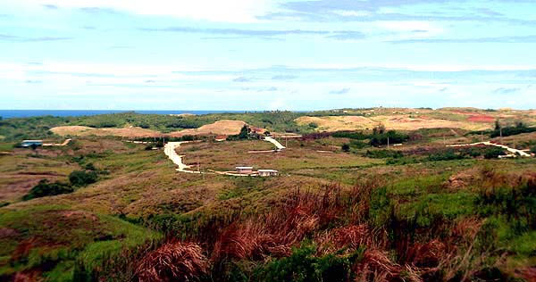
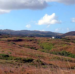
Upland Regions: Rufo describes that there are three major upland regions in Inarajan: Ija, the region towards Merizo; Atate, the central and largest region; and Dåndan, towards Malojloj. “From a geographical perspective, and I’m giving you my opinion, Ija, Atate, and Dåndan are the three largest sites. You talk to somebody else, they’ll probably argue. I’m looking at it in terms of size, geographical size. A lot of the place names just refer to small areas. "Ija is a large area. Next to Atate, it’s the next largest region in Inarajan. It extends all the way up into the hills, and it goes from there to almost the back of the elementary school in Inarajan. The Agfåyan river runs through the middle of it. "
|
||
|
|
||
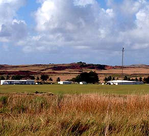
| “Ija provisionally was set aside as a community pasture for the residents of Inarajan and also from Merizo. The reason that was set aside as a pasture is because of the wind conditions. It is a windy area, so the only things that grew up there were shrubs and sword grass. They are the only things that can withstand the wind." "Now you see an agricultural experimental station up there, and you see houses up there. But what’s going to happen is the valley has a funneling effect on the wind. Even if those houses are concrete, if they are not built to the strength of that funneling effect, they are going to be destroyed. "Now I live in Talofofo, and there’s a valley there where I’ve seen concrete walls get twisted by the effects of strong wind. And these are concrete walls that are supposed to withstand 200, 300 miles per hour of wind. Yet they get twisted."
|
|
|
|
"When you go inside Malojloj, where the NASA tracking station is at, that’s Dåndan, another big region. Dåndan extends all the way to the Ugum river boundary with Talofofo. And inside of Dåndan is Tuponi, another region. "These were all farming and ranching sites in the old days. People have their chicken farms or pasture their cows, their carabao. These areas were also used for gleaning, like going picking betel nut or medicinal plants. And also for hunting deer or wild pigs. "The deer that we have here were introduced by the Spanish in the 1700s, for the pleasure of the Spanish gentlemen to hunt. The Spanish introduced the carabao, the deer, the cattle, the cat, the Philippine Turtle Dove, and the Dwarf Painted Quail. They were introduced either for beast of burden, or for hunting."
|
|
|
|
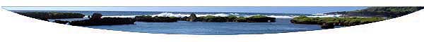
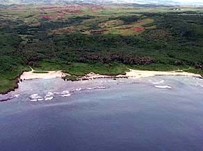
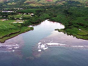
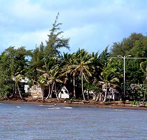
A park occupies the floodplain behind Inarajan Bay.
|
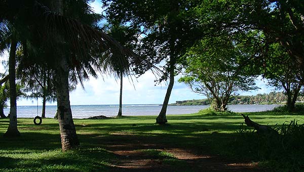
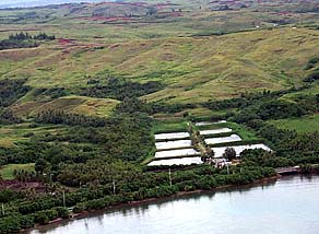
Floodplains: "Inarajan has three major floodplains. These are areas that get flooded, so they are reserved for agricultural activities. You would have rice paddy, and also during the dry season when it is not inundated, the people would farm there," Rufo explains.
|
||
|
|
||
| "You have the flood areas of Nomna and Tinaga, which are separated by a hill, so they form two different drainage basins. And then you have the Fama‘åyan, 'rice-planting place,' which is the floodplain for the Atate region. And then further down is the Agfåyan area. "Ija drains into two different systems. The southern part of Ija drains into the Ajåyan River, that plain down there. And then on the northern side, which is towards Inarajan, it drains towards the Agfåyan River. "In the old days, you saw all these houses built on stilts. When we were growing up, people had houses right along the shores of Inarajan Bay. And then after the 1949 typhoon, my father took the family up to check on our relatives, and I recall that there were houses floating in the bay. They got washed out to sea by the waves."
|
|
|
|
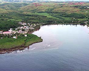
"Because of that, the government set aside a buffer strip where you have no buildings, but that is being violated. Now you go down to Inarajan, you see houses built on this flood plain. People forget why the community reserved that area for a certain purpose. And that’s from years of observations. "I hate to say this, but Gef Pa’go Cultural Center, that's not even supposed to be there. It’s in that buffer that’s supposed to be a no-building zone. There’s another house across the bay that’s still in that danger zone. "They’ve been lucky so far, but with typhoons, it depends on the wave conditions in each bay, and on the direction of the typhoon. If the typhoon comes up from a certain direction, then a bay will get hit."
|
|
|
|
"In Inarajan, somebody thought, 'We should have a shoreline setback,' and that’s why they set that buffer zone. But then people forget. And so they go back, and then when all the conditions are right, and you have destruction again, they say, 'Oh, that’s why they did that.' Like that house right next to the mouth of the bay, on the Southern side of the bay, and then you have Gef Pa’go Cultural Center—they are going to be destroyed by Nature. A reminder that 'I’m the boss—take heed'."
To understand the nature of the destruction experienced on Guam, we turn now to winds.
|
||
|
|
||
|
|
|
|
|
|

|
| Inarajan Home | Map Library | Site Map | Pacific Worlds Home |
|
|
|
|
|
 |

|
|
|||
| Copyright 2003 Pacific Worlds & Associates • Usage Policy • Webmaster |
|||