 |
 |
 |
|||||
|
|
|
|
|
|
|
|
|
|
|
|||||||
|
|||||||
At the time of the 1848 Mahele, the ahupua‘a of Ha‘ena was reserved for Abner Paki. Carol reports that "Paki had apparently held Ha‘ena prior to the Mahele. He and Konia [his wife] had approached the Privy Council with an undated request to purchase the Government's share of the ahupua‘a. A resolution was drawn up and approved granting their request (Privy Council Minutes v.3 p. 573). Paki laid a formal claim to this land before the King and Ha‘ena was awarded to him under L.C.A. [Land Commission Award] 10613. Although he retained interest to the entire ahupua‘a, those parcels claimed and awarded to bona fide native tenants were excluded from his control. The rights and privileges of these native tenants to their house and farm lots were now guaranteed by virtue of this Mahele."
|
||
|
|
||
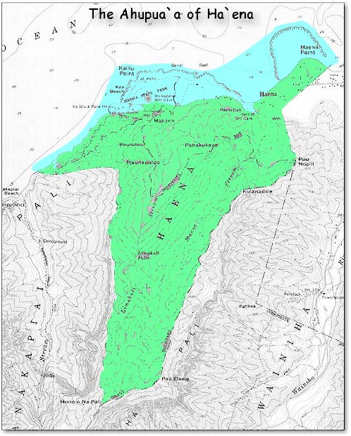
Apart from the kuleana lands awarded to individual tenants, Abner Paki was awarded the entire ahupua‘a of Ha‘ena. As ali‘i, he held ultimate control over the resources within the ahupua‘a, including water sources and products from the mountains and seas. Within Ha‘ena he had twelve ko‘ele (parcels). Carol tells us that "The Ha‘ena award was made 'in name only' which indicates that the land received was neither described nor surveyed at the time of deeding. Paki died in 1855; Konia followed him in 1857. Their only child and heir, Bernice Pauahi Bishop inherited their lands and in 1858, sold Ha‘ena to W.H. Pease." Meanwhile, several parcels of land had been awarded as kuleana.
|
||
| |
||
|
|
|
Twenty-three native claims, in addition to Paki's claim to the majority of the ahupua‘a, were awarded in Ha‘ena. Carol notes that 15 of these claimants "stated that their parcels had been received prior to 1824 during Kaumuali‘i's reign. Seven identified their claims as having been given since Kekela's tenureship in 1839. "Eight of the 23 had received their lands directly, three had inherited their parcels from their fathers, one from his grandmother. Six claimants were registering parcels that had come to them as a result of marriage (ie. a widow of a tenant remarried and her new husband registered her claim under his name or a widow and child laid claim themselves).... "Haena thus sustained a majority of its original tenants from Kaumuali‘i's time and the residential and agricultural patterns were largely preserved during Kekela's management." Carol suggests that due to Kekela's long association with the neighboring ahupua‘a of Lumahai, she would have been familiar with the older Ha‘ena residents, and could not easily dispossess them, especially if they were good productive keepers of the land and respectful of her office.
|
||
|
|
||
Ha‘ena Kuleana Awardees
|
||
| Haole |
Kukukaelele |
Nahialaa |
Click here to see a complete listing of mahele claims for Ha‘ena. |
||
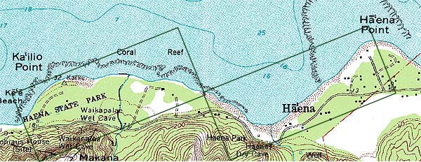
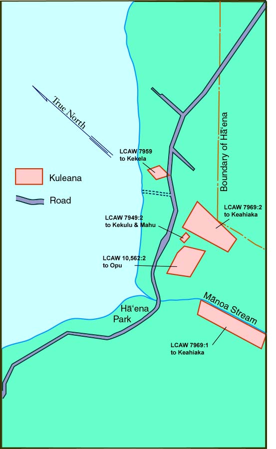
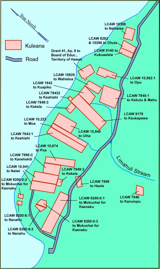
Kuleana lands were mostly on the makai or ocean side of the ahupua‘a, in the lowland agricultural zone. The following map, in two parts along the shoreline zone, show the Land Commission Awards (LCAW) from the Mahele and identify the recipients. Parcel sizes, in the Hawaiian language documents (and the notes were written in Hawaiian well into the 20th century) were in acres (written as "eka"). Other forms of land measurement used included "rods," "roods," and "chains."
|
||
|
|
||
Kuleana lands on the Wainiha Valley (Hanalei) end of the Near-Shore Area.
|
|
While many residents who probably applied did not receive kuleana lands, a special development occurred in Ha‘ena that allowed them to remain in residence, using the land. First, it is important to look at the society of Ha‘ena during this time.
|
||
|
|
||
| |
| |
|
|
 |
| Ha'ena Home | Map Library | Site Map | Hawaiian Islands Home | Pacific Worlds Home |
|
|
|
|
|

|
|||
| Copyright 2001 Pacific Worlds & Associates • Usage Policy • Webmaster |
|||