 |
 |
 |
|||||||||||||||||||||
|
|
|
|
|
|
|
|
|
||||||||||||||||
|
|
|||||||||||||||||||||||
|
|
|
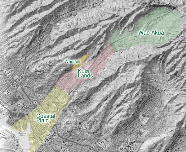
Map showing the different areas that comprise Nu‘uanu Valley.
|
|
|
Nu‘uanu presents a special kind of geography, in that it is a very long valley, going from sea level up to a very moderate elevation at the very back. The shift in character is a gentle one, and with most people using the fast-moving Pali Highway, the transitions are easily missed. Our guides present different ways of viewing the transitions of Nu‘uanu. Stephen considers traditional land use areas and ecological zones: "Archaeologists describe a 'hydraulic infrastructure' of the ahupua‘a. This is defined by heiau and the valley agricultural systems—the auwai, the lo‘i, and the fishponds. Those are the main organizational structures of an ahupua‘a, and accord with what we would call 'management areas.' The ahupua‘a, the ‘ili, and the kuleana, these are really 'land use districts' in today’s terms, articulating the kinds of uses that were permitted. "At the same time, these management zones correspond closely with ecological sub zones. The ecological zones are the wao akua, the kula, and the kahakai. The two types of zones went hand in glove. If you see the term wao akua, you know that’s really an ecosystem zone. But within that area you would have patches of subzones or subdivisions that may have had a caretaker, so you see a house lot, and you see uses within those subzones."
|
||
|
|
||
|
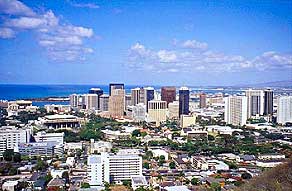
Kahakai: "You have to start at the shoreline," Stephen says, "because that’s where Hawaiian culture started. The first voyagers settled along the shoreline. If you’re going to understand the evolution of ahupua’a, we have to start at the shoreline, and then work our way up. Generally the ancient shoreline area, called the kahakai, characterized ecologically as dryland forest. There are variations, depending on the unique local ecosystem, but because it’s also on the leeward side, we know that it didn’t get as much as the windward or Ko‘olau side." The Honolulu coastal plain is technically raised coral reef limestone from a time when the sea level was higher. Being low on the leeward side, it is hotter and drier than other areas of the island.
|
|
|
|
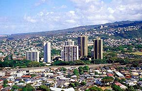
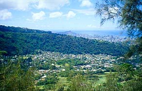
Kalani differentiates between "Honolulu"—the coastal plain—and Nu‘uanu the upland valley: "I consider Honolulu to be part of Nu‘uanu but I also think of Nu‘uanu being separate at the same time. I guess I’m just accustomed to saying that Honolulu includes this area; but I would say “downtown” rather than "Honolulu." I would say 'Honolulu' if I were on another island, but here I would say 'town,' or just makai."
|
|
|
|
|
||
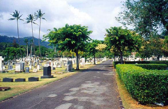
| Kula: "Nu'uanu was always cool," Kalani continues, pointing out a transition "when you come up and you approach Mauna Ala after you are passing O‘ahu cemetery on the left. If you are coming up to Mauna Ala from town on any day--especially a warm one--you immediately feel the breeze just at Mauna Ala. Everyone I knows goes, 'Aaahh, at last.' And we can feel it. And that is one of the wonderful things about living up here." But it is a transition of activity as well: "All of us are greatly relieved that commercial activity stops down there, just below Judd Street. We would probably be up in arms if anyone wished to come up further and set up a store. There’s only one store this far up between town and up here. And then further mauka of La‘imi Street there is no store or gas station, no anything until you get into Kane‘ohe. And I know that’s what the residents like. They don’t want any commercial activity to take place up here."
|
||
|
||
|
This upland area would normally be the kula. "The kula is more the land without water," Stephen states. "In about the 1860s they passed a law defining kula lands as all the lands above the auwai. Conversely, taro lands would be the lands below the auwai. Anything above that, in terms of elevation, would have been the kula lands, because there was no way to irrigate." But in the case of Nu‘uanu, as we will see in the Water section, the valley was irrigated extensively up very close to the Pali itself. This central section of the valley was extensively irrigated. So the real difference here is that this region was irrigated by auwai, while the kahakai--the coastal plain--was irrigated by springs. At the higher reaches of this central area, the Hawaiian term wao kanaka can be applied. Stephen says, "You can see that this area would have been a wao kanaka because it was where human habitation and agriculture was permitted." As if to make the point even clearer, Wao Kanaka Street marks the last major intersection going up the Pali Highway.
|
|
|
|
|
|
|
||
|
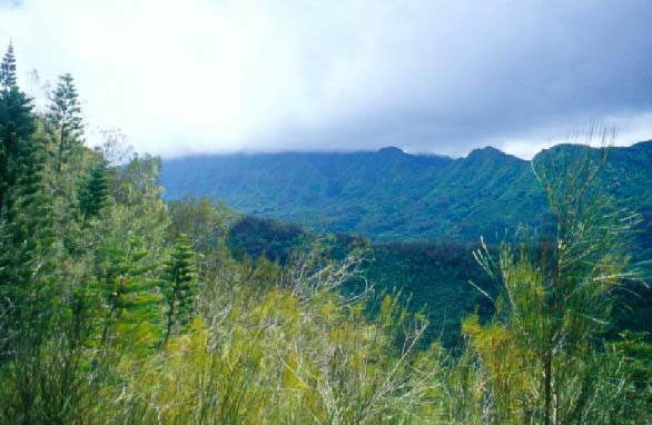
Wao Akua: "Further up from here it would have been a wao akua" says Stephen. "In the poetic language, that's where the spirits of the forests live, which is very graphically illustrated by the mists, and the fact that there isn’t evidence, up in the hills and the area around the reservoir, of planting. Your clues are in what remains of the architectural, archaeological features."
|
||
|
|
||
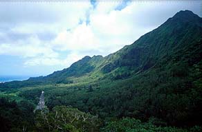
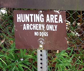
"About where the last set of lights are at Wao Kanaka Street, where traffic goes on to the Pali," Kalani confirms,"that would be another transition, which developed because of the lights there. After that point, there are no other lights until you reach the tunnels. It’s also strictly Conservation land after that, after the end of the Country Club golf course. It's Conservation on up the mountain." "There are pig hunters who hunt this area because it is now in a Conservation district and reserved for bow hunting" Stephen says. They said that deep in the forest, they could see the remnants of ancient heiau, which would have been associated with taro. They are way back in back, in the mountains. The hunters talk about spirits in the forest where they hunt the pig. "
|
|
|
"These bow hunters developed a kind of protocol of their own," Lynette adds. "Part of it had to do with how they enter into the forested areas, how they dressed, how they smell. Strict rules and guidelines about never leaving anything behind. Every time you go in you must take out everything that you take with you, so that there is no evidence of your having ever been there. "They are very concerned about keeping the area clean, and about hikers meandering all over the place, and getting hurt—because I think the trails are not really clearly marked—and you could get injured. And because hikers leave stuff, they leave evidence."
|
|
|
|
These different areas are strongly characterized by their environmental conditions. Now we turn our attention to the winds of Nu‘uanu.
|
||
|
|
||
| |
| |
|
|
 |
| Nu‘uanu Home | Map Library | Site Map | Hawaiian Islands Home | Pacific Worlds Home |
|
|
|
|
|
|
|
|||
| Copyright 2003 Pacific Worlds & Associates • Usage Policy • Webmaster |
|||