 |
 |
 |
|||||||||||||||||||||
|
|
|
|
|
|
|
|
|
||||||||||||||||
|
|
|||||||||||||||||||||||
|
|
|
|
|
|
|
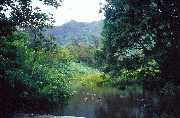
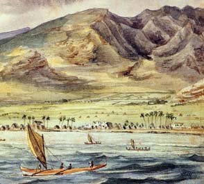
Nu‘uanu was the main provider of food for the Honolulu area in olden times. Yet today there is little obvious indication that this valley was a major area of agricultural production. The Pali Highway zooms through old suburbs and streets, while the upper reaches of the valley lie hidden in conservation areas or large private properties. "There was taro growing all the way up" Stephen explains. "If you think about the long history of Hawaiian culture, the first voyagers settled on the coastline and the logical thing was to develop down below. Then through the centuries, gradually development moved inland. Today what we have remaining as evidence is mostly in the uplands, though these are the most recent remnants. " The extent of cultivation in Nu‘uanu can be discerned from the historical records, old maps, and even a few rare old photographs. In our exploration, we will start from the shoreline and extend towards the Pali.
|
||
|
|
||
|
"As you come inland from the shoreline, you get into the areas known for agricultural use," Stephen points out. "Classically, if you were near a stream, it was taro; if you were up on the hillsides, you were into sweet potato, dryland crops. "In Honolulu, there’s been so much alteration done that it’s hard to tell, but if you use an ecological interpretation, it’s easy to imagine that there was extensive taro.This was a royal ahupua‘a. Even before Kamehameha, the Honolulu chiefs were powerful, because that harbor was important. "What you had down here were springs, a lot of them in this area. They didn’t need auwai to irrigate because there were springs, and that was the original source of water for taro patches. That was a common feature in this area." |
|
|
| |
|
|
“When Kamehameha went to Nu‘uanu, mounted on his horse, Kawaiolaloa, many of the children, including ‘I‘i, followed him with great interest," wrote John Papa ‘I‘i (1959: 68), an attendant to Kamehameha II. "They found innumerable people all over the farming area, from down below the present road at Niuhelewai to the bend in the road where the houses of the Portuguese now stand." It is often remarked that after the battle of Nu‘uanu, Kamehameha immediately set about restoring the agricultural capabilities of the valley. We recall from the Old O‘ahu page in the Native Place chapter how this area had already been devasted by previous battles.
|
|
| Now he had to feed his large army as well as the local inhabitants. ‘I‘i (1959: 68) describes the preparation of lo‘i near to Kamanuwai and Peleula, close to Honolulu: "The men, scattered systematically from a spot on the upland side to place on the seaward side, dug and beat on the banks with dried coconut-leaf stems. The next day they trampled the wet patches and planted taro." ‘I‘i adds that regarding the tilling of the fields, “These tasks Kamehameha attended to personally, and he participated in all the projects.” |
|
|
|
“The places Kamehameha farmed and the houses he lived in at those farms were show places" ‘I‘i continues (1959: 69). "His farmhouses in Nu‘uanu stood several hundred fathoms away from the right side of Kapaehala, a knoll on the western side of Nu‘uanu street and Hanai-a-ka-malama House. Perhaps the location was chosen to enable him to look both inland and seaward to his food patches. Some elevated houses seem to have been built for that purpose.” "We can’t underestimate the extent of taro or importance of taro in Hawaiian culture," Stephen remarks, "but I always point out that taro is a symbol of a whole range of farming activities. It wasn’t a mono-crop: you had bananas, you grew sugar cane, you grew all kinds of other plants with ethnobotanic uses. So the whole idea was, wherever a family settled or a community developed, it was because there were resources in the environment around them."
|
|
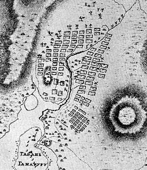
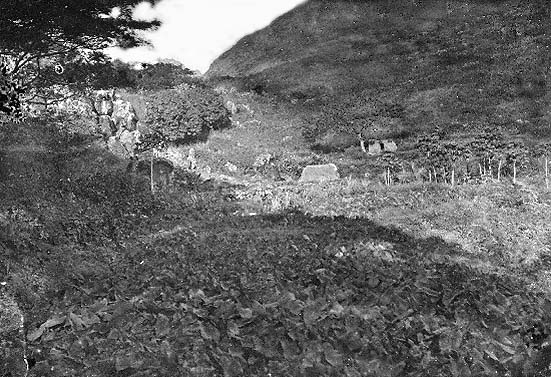
"Taro Patches in Nuuanu Valley,
Honolulu Hawaii" (no date).
|
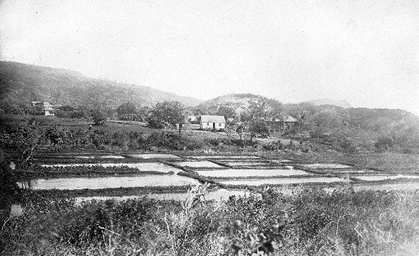
| That central Nu‘uanu was heavily cultivated is certain. The extensive auwai system discussed on the Water page attests to this area being heavily planted in taro. Kamakau (1992: 291) writes that "It is said that from Kahapa‘akai clear to Hapu‘u it was in old days a beautiful highway through charming villages with manienie grass on either side of the road and garden patches where grew taro, potatoes, bananas, ‘awa, wauke, sugarcane, olona and all the fat things of the land."
|
||
|
|
"The existence of the extensive Paki auwai system," Stephen adds,"that’s further evidence. Auwai was for taro, and so a lot of the lands in here were taro patches. The land still holds clues, and you see areas that show presence of water in the ground." "The evidence is that the chiefs lived here. One thing we always forget: if the kings were here, the royal families were here, and they had retinues, they had staff servants, they were hosting guests. They had taro. They had water. This is all before the Board of Water Supply and modern plumbing, or importation of foods.That’s the broad historical perspective." Handy (1940: 78-9) writes, "From Waolani to Kapalama the terraces were continuous on the level and gently sloping between land between Nu‘uanu and Waolani streams, past Wyllie and Judd Streets and throughout the section on the north side of the valley, down what is now Liliha Street. In many vacant lots, yards, and gardens above and below Judd Street traces of terraces may still be seen."
|
|
|
|
|
|
||
While the extensive level land and the auwai system in the lower and middle portion of the valley allowed for fairly widespread cultivation, the upper reaches of Nu‘uanu seem to have been less extensively utilized. Handy (1940: 78-9) writes, "In upper Nu‘uanu there are many small valleys which open into the main valley on either side of the stream. Traces of ancient terraces have been discovered in several valleys on the steep slopes above the stream beds, below the falls, and on small flat areas along the sides of streams. Probably all these small valleys were used for planting taro in ancient times." Handy adds that "Luakaha doubtless had many inland gardens; but there were no wet terraces that far up."
|
||
|
||
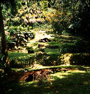
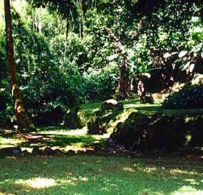
| "This land was called Luakaha," Stephen says, disagreeing with Handy. "It’s an ‘ili of Nu‘uanu. There was a large population here that was raising taro. What we call Reservoir 4 actually, in ancient times, was a large taro system which was being fed by waterfalls." Some remnants of the taro terracing remain on the property now called Luakaha, along with small ditches running from the stream that would have been minor auwai. The property at Luakaha reveals a number of small remnant terraces. The Paki auwai runs right past the property, and it is evident from a number of ancient sites there that this was once an important area, perhaps part of the heiau complex of Kaniakapupu.
|
|
|
|
|
|
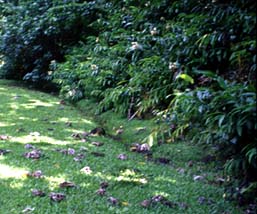
Agriculture is effectively gone from Nu‘uanu today. Does this mean that restoring this area as an ahupua‘a is out of the question? We will explore this in the final chapter, Onwards. Meanwhile, let us hear some of the wondrous stories associated with sites in the valley. These are the Footprints left by the ancestors.
|
||
|
|
||
| |
| |
|
|
 |
| Nu‘uanu Home | Map Library | Site Map | Hawaiian Islands Home | Pacific Worlds Home |
|
|
|
|
|
|
|
|||
| Copyright 2003 Pacific Worlds & Associates • Usage Policy • Webmaster |
|||