 |
 |
 |
 |
||||
|
|
|
|
|
|
|
|
|
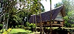
| Orientation to Airai | |
|
|
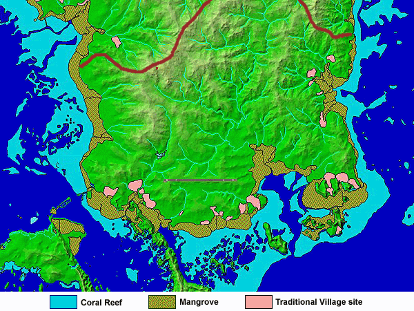
"Airai stretches across both sides of Babeldaob, from East to West," Johnson explains. "It is at the end, the south end of Babeldaob, so we have shorelines on the east, west and south. "All the states of Palau reflect the traditional organization of Palau. We have separate entities such as Airai and Aimeliik. And you cannot mix Airai and Aimeliik, or Airai and Ngchesar, or Airai and Koror, even though we are neighbors."
|
||
| |
||
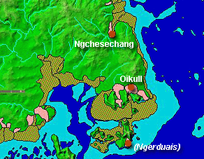
"Then within Airai State we have hamlets," Johnson continues. These hamlets are also referred to as "villages," so the terminology can be a little confusing. "Maybe historically there were nine villages," Johnson says, "but now we have only six. "We have, on the northeast side of the state, Ngchesechang and Oikull. The villages on that side of Airai State are collectively called Desbedall." Ngerduais is an ancient village on this side, whose story we will see.
|
|
|
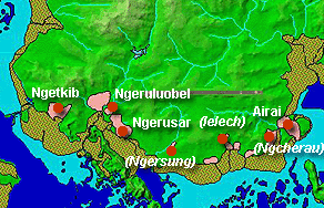
"Then we have Airai Village, or Irrai, also called Ordomel, that is the central village, the principal village where we are going to. That is the main village. Then on the side toward Koror State, we have Ngetkib, and then when have Ngeruluobel and Ngerusar hamlets. "There are councils of chiefs for these six hamlets. So for example Ngeruluobel village has their own council of chiefs. But, traditionally they are subordinate to our council of chiefs, the Ngara-Irrai. They are like satellite hamlets. We are the main village, where the Medechiibelau sits."
|
|
|
|
"The council of chiefs from our village, which is like the central or principal village, is called Ngara-Irrai. And we have names for the hamlets’ councils of chiefs. And then when we meet, we meet in our village—they come there. And then when they all get together we call them rubekul a Ngerechumelbai. Ngerechumelbai is another name for Airai, the whole place."
|
||
| |
||
|
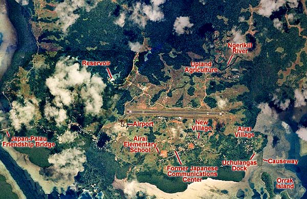
On this composite aerial photograph, covering most of Airai State, are identified some of the major landmarks in Airai: —The Japan-Palau Friendship Bridge, site of the former K-B Bridge (for Koror-Babeldaob) is the "gateway" to Airai State (and all of Babeldaob) from Koror State. It is still today refered to as the "K-B Bridge." —The airport serves Koror State and all of Babeldaob —Airai Elementary School also marks the location of Belualaruchel , the home of the gods —the former Japanese Communications Center was important during the Japanese administration, and remains an important WWII ruin —The "New Village" is a substantial new population cluster in Airai State —Airai Village includes the Uchulangas landing place, Orrak Island, and an important legendary causeway built across the channel between the two.
|
||
| |
||
Airai Village.
|
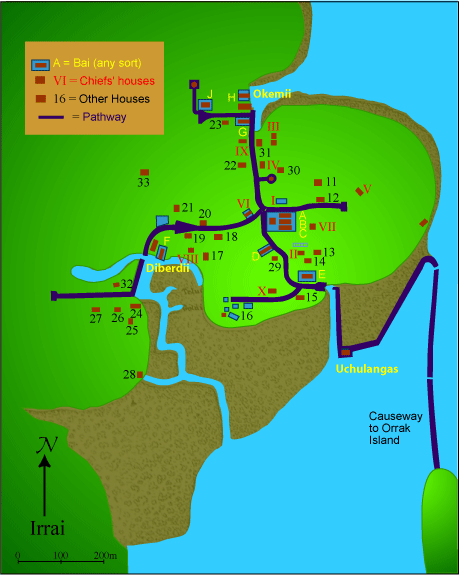
This map of Airai (Irrai) Traditional Village is based on the map made by Augustin Kramer (1919). We will use it in various ways to illustrate different features of the village: — The stone pathways that define a traditional village — The various bai — Homes of the ten clan chiefs — Other Houses — The three landing places (Okemii, Diberdiii, and Uchulangas) as well as their water trails up the estuaries through the mangrove.
|
||
|
|
||
|
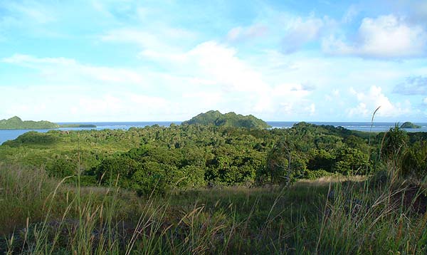
As the map above shows, Airai Village sits on a peninsula projecting into a bay. In the photograph above, Airai Village sits in woods in the center. The hills in the center rear is Orrak Island. The peninsula to the left rear is where Ngerduais village sits, across the bay.
|
||
|
|
||
|
We will explore many more areas of Airai State. But first, we need to get there.
|
||
|
|
||
|
|
|
|
|
|

|
| Airai Home | Map Library | Site Map | Pacific Worlds Home |
|
|
|
|

|
 |
|
|
|||
| Copyright 2003 Pacific Worlds & Associates • Usage Policy • Webmaster |
|||