|
National Estuarine Research Reserve (NERR):
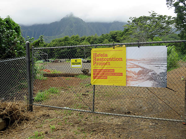
A gate just down from the entrance to Hoi identifies where some of the stream restoration is taking place.
In 2017, He‘eia fishpond and the estuary of the He‘eia ahupua‘a were designated a National Estuarine Research Reserve system under NOAA, the National Oceanic and Atmospheric Administration.
The reserve encompasses “1,385 acres of unique and diverse upland, estuarine, and marine habitats within the He‘eia estuary and Kāne‘ohe Bay of the island of O‘ahu. It protects features such as the He‘eia Stream, coral reefs, sand flats, and traditional agricultural and heritage lands, such as the He‘eia Fishpond. Reserve lands support wildlife, including the federally endangered Hawaiian stilt, moorhen, coot, duck, and hoary bat.
“Marine waters make up the largest component of the reserve and feature Moku o Lo‘e (Coconut Island), home to the University of Hawai‘i Institute of Marine Biology. Coconut Island is surrounded by the Hawai‘i Marine Laboratory Refuge, which includes the most pristine coral reefs in the site.”
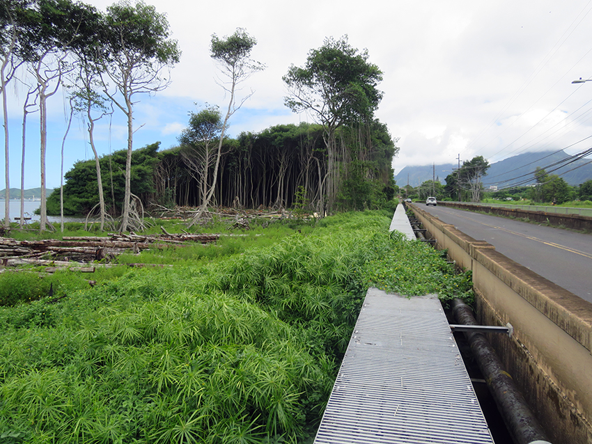
This area, on the mountain side of the bridge, was previously overgrown with a forest of invasive species. It has been cleared as part of the restoration.
“The National Estuarine Research Reserve system with NOAA is one of those federal tools,” Kanekoa explains. “It doesn’t change regulation or ways to manage land, it’s just a federal overlay of support. Landowners still have full autonomy, management, as long as we all agree to the same goal of restoring ‘āina and food. It’s a tool the feds use, which is a very soft tool, not like a preserve or other types of reserves over here where there’s no fishing, no interaction. It’s an overall system to understand how climate change is.
“The Clean Water Act prevents us from working in tidal estuaries to dredge. Any stream channel, we can’t dredge, but we are working with Army Corps and Division of Aquatic Resources to get the determination whether we need permits or not to revitalize those streams. The issue now is money. So we have a pretty big leeway that allows us to grade our taro patches so that we can farm. But once we get within 100 feet of the stream channel, we have to stop. Which is fine, we have 30 acres to go for before we touch that.”

On the ocean side of the bridge, the invasive forest is also being cleared.
“I think the NERR is important,” Rocky states. “That is important because now we’re finally getting federal help. The state and the city helped us as much as they could, but federal help is coming and they can give some funding. The state, we already got the state in this last legislative session to give some matching funds. The state is going to give us $300,000 or $100,000, and the federal government is going to be matching so much money.
“That’s good, because it’s not putting any more rules and regulations into the bay, it’s actually monitoring the bay. And also, we’re going to be working with the military, with the Hawai‘i Institute of Marine Biology, the state, the city. And actually, we helped to start that, the Ko‘olaupoko Hawaiian Civic Club, the Kako‘o ‘Ōiwi lo‘i people, Paepae o He‘eia, and the Department of Land and Natural Resources, the parks division. We are partnered into this. That’s something important."
|