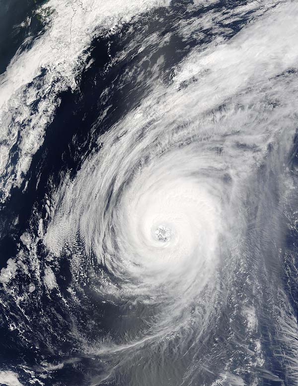
The MODIS instrument on board NASA's Terra
satellite captured this true-color image of Typhoon Sudal on April
14 at 1:55 UTC. At the time this image was taken, Sudal was located
approximately 547 miles west-southwest of Iwo Jima and was packing
sustained winds of 117 mph with gusts to 132 mph. Sudal was moving
northeast at 16 mph.
Typhoon Sudal passed through Yap State on Friday 9 April,
2004, causing extensive damage to public and private utilities and
food crops in the mainland of Yap. Ulithi and Fais were also struck
by the typhoon. There were no reported fatalities or missing persons,
and just 8 people required hospital treatment. However, approximately
1,000 people were estimated to be homeless, some 500 of whom were
in public shelters, the others staying with relatives.
Sources:
Image courtesy Jacques Descloitres, MODIS Land
Rapid Response Team at NASA GSFC.
http://earthobservatory.nasa.gov/NaturalHazards/
natural_hazards_v2.php3?img_id=12073