 |
 |
 |
 |
||||||
|
|
|
|
|
|
|
|
|
|
 |
|
||
|
Orientation to Hā‘ena | |
|
|
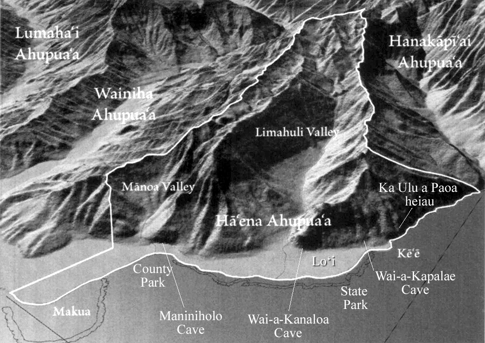
The ahupua‘a of Hā‘ena encompasses two valleys: the shallow valley of Mānoa ("thick") and the deeper valley of Limahuli ("turning hand") are separated by Ka-iwi-ku‘i Ridge. Though Mānoa valley was clearly used for both agricultural and ritual purposes, the much larger Limahuli valley dominates the landscape of Hā‘ena. Each valley has a permanent stream. Three caves—two wet and one dry—and Ka Ulu a Paoa heiau are among the many storied places from ancient times. Today, the area is mostly noted for two park areas, and the National Tropical Botanical Garden that occupies most of Limahuli Valley. Near Kē‘ē beach begins the Kalalau Trail, a 10.5-mile hike along the dramatic Nā Pali coast. Because of its historical importance and its importance as the major site of habitation and agricultural production up until recent times, the area encompassing Kē‘ē Beach, Hā‘ena State Park, and the mouth of Limahuli Valley receive the most detailed treatment in this study. |
|
||
|
Changes in transportation technology and land use today leave Hā‘ena at the far end of Kaua‘i from the centers of commerce and activity. Though it is a very much visited locale, famous for its beauty, beaches, and access to the Nā Pali coast trail, today one undertakes an adventure in getting here.
|
|
||
|
|
||||

|
|
|
|
|
|
|
|
||||
| Copyright 2018 Pacific Worlds & Associates • Usage Policy • Webmaster |
||||