|

|
 |
 |
|
Thematic Essays: Methods
for Oral History
|
|
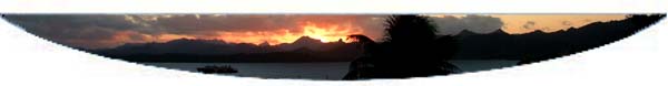
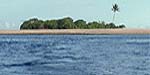
"Voyaging" by Carlos Andrade "The first four and a half days had been crisp, and clear. Well-defined swell trains born in Antarctic waters had accompanied us along with pelagic albatrosses and shearwaters till we sighted Raul, one of the Kermadec rocks that served as a touchstone to our non-instrument wayfinders. Kalepa, the apprentice had made his first successful landfall putting into practice the lessons he had learned from Nainoa that was five days ago. On this our ninth day, we had seen no land for five days. Our navigator had told us that we should see land sometime this morning. No compass, sextant or any other kind of instrument has been used on this thousand-mile passage that was just one of many that had begun in Hawai‘i. The previous passages had brought the voyaging canoe, Höküle‘a south from Hawai’i through Tahiti, Ra‘iatea and Rarotonga to Waitangi in the land of the long white cloud, Aotearoa. "We left Waitangi on Te Ika a Maui (North Island N.Z.) to follow the ocean highways of our Polynesian ancestors, after re-establishing contact with our far flung cousins, the Maori. The stars, wind and swells spoke to our navigators; they were the eyes of the wa‘a. We, the crew, were the muscles, the hands that pulled on the lines that were the sinews that moved the wings, of the great bird of a canoe we rode upon. The sails were angled to catch the lift of the wind and urge the twin hulls to skim and slice on the skin of the sea. The stars, wind and swells spoke to our navigators; they were the eyes of the wa‘a. After the relative comfortable conditions of the first four days, a storm had now become our companion on the sea. The last four and a half days had been a continuous test of roiling clouds, whistling wind and mountainous seas that charged at us from two quarters. Heaving balls of foam would slide down the slopes and crash into the twin hulls of the canoe and leap the sixty foot length of wooden parts held together with miles of lashing, drenching the steersmen, navigator and anyone else on deck. Below the flimsy canvas shelter (there is no below-decks on this vessel), the rest of the crew tried to rest but as our Tongan crewman said, 'inside, same wet as outside.' "We strain to see in the little light left by stars that intermittently show themselves. Orion has died long hours ago in the West. The three stars in the handle of the Dipper beckon like a bird’s wing above the northern horizon. The Southern Cross sinks into the south as we plunge through the predawn. There! Sione sees it forty-five minutes before the rest of us. A darker shadow solidifying on the horizon as the sun climbs ups the back of the easterly winds. "Low, ringed by coral fingers that reach out miles into the surrounding ocean, Tongatapu, the sacred southwest, spouts white with blow holes carved into her flanks by the ceaseless mauling of the sea. We initially mistake them for whales and laugh with relief knowing that dry beds, solid ground and hot meals await us when we land. The navigator can rest now. Like Maui with his mighty hook, he has fished the land from the sea. He has raised the island. Although, we are within close proximity of the island, it is Sunday in Tonga, so we wait another night at sea. Tomorrow we enter the realm of dance, song, protocol and feasting. For now, thanks are given in prayer to Akua." The preceding is an actual account of a voyage that took place in 1985 as part of a larger project called the Voyage of Rediscovery. Since 1976, the art of long distance voyaging has been reinvigorated in Hawai‘i. The voyages of the Höküle‘a have just about erased any doubts about the navigational capabilities of the people known to the European world as the Polynesians. Captain Cook, the European navigator most widely acknowledged as the first explorer to land on the Hawaiian islands was astounded by the what he considered to be the most widely spread nation on the earth. He had met people who spoke the same language and who followed the same customs and practices that inhabited the lands from as far south as the islands known as New Zealand; throughout the eastern South Pacific and as far north as the Hawaiian Islands. Most anthropologists today feel that these people had originated in the region know as Southeast Asia, an area of many large and small islands, relatively close together. In this region of many islands, the people perfected their skills of ocean going and wayfinding until they were able to reach farther and farther out into the largest body of water on the earth, known to us as the Pacific Ocean. Over many thousands of years, they were able to master the art of living on islands and built up a technology of building and sailing vessels that were able to cross thousands of miles of ocean without the comforting sight of land to make landfall on lands as small as tiny atolls built of sand on low reefs and as large as the volcanic islands of Hawai‘i, Tahiti and the cold islands of New Zealand. Part of the technology that they developed was a technology of the mind. This technology enabled the people who became navigators to keep their sense of direction using a variety of references while they were out of sight of any landmarks. This science of wayfinding was passed on from generation to generation by way of lessons taught on the land, by games and exercises designed to sharpen the memory and by a system of visualizing the shape of sky and using the shape of the ocean swells in such a way that they could keep their canoes going on the right course. The primary level of the reference system included the stars and the secondary level included the appearance of other heavenly bodies like the sun, moon, and planets. When these referents were unavailable, such as during storms, cloudy nights or during the day, the waves that crisscross the oceans of the worlds lay out patterns that tell a skilled navigator whether or not he is on course or not. Other clues are more subtle. Birds, other sea animals, colors reflected under clouds are among these signs that only an experienced navigator can effectively use. In ancient times, voyaging was a skill that was highly valued by the people of Oceania. Navigators held a high place in the various island societies, especially the smaller islands that lacked the abundance of resources that the larger islands possessed. These navigators from the small islands were necessary for the survival of their people as they afforded the people access to uninhabited islands and reefs far from the sight of land where fish and other necessities could supplement the hard-pressed resources on the inhabited islands. However, many stories told about the voyaging that took place in those times indicate that multiple journeys took place between such far flung islands as Hawai‘i, Tahiti, Samoa, and Aotearoa just for the adventure of finding new lands, seeking out long unseen relatives and bringing new plants, ideas and systems of government. Spending long periods of time at sea requires much preparation and organization. The building of a canoe that could negotiate the many changes of wind, sea conditions and weather required on a long journey was the result of the work of many people over a long period of time. The immense investment in time and material needed to build a seaworthy vessel made the canoe a highly valued member of the ocean going societies. Canoes were given celebrated names. Special rituals accompanied every stage of their construction beginning with the cutting of the trees, extending to the launching day and continuing for every departure and arrival. They were given a special place in the community and the men who cared for and sailed them had to have special skills that took years, in some cases, to acquire. The navigator was primarily important in that he acted as the eyes of the canoe, keeping the vessel on course. When Nainoa Thompson, the Hawaiian navigator of the Höküle‘a, was serving his apprenticeship under Mau Piailug, the master navigator from Satawal in Micronesia, he was asked if he could "see" the island that was the target. At the time he was asked the question, he was concluding his training and was standing on the eastern shore of O‘ahu. Mau had asked the question several times. Nainoa had to be able to visualize the island and keep the location of the island in his mind as he climbed east up the tradewinds, negotiated the changing moods of the area known as the Inter Tropical Conversion Zone and re-engaging the mirror-image southern hemisphere winds to angle through the atoll studded Tuamotu archipelago to raise the island of Tahiti from the sea. Like the navigators of old, Nainoa succeeded, not once but several times and extended his skills by negotiating ocean routes that are recorded in the oral traditions many hundreds of years old. The experience of a navigator at sea is a rigorous, physical and mental exercise. He does not get much sleep. The reason for his having to be awake is that he has to know exactly how many miles he has traveled and in what direction the canoe has traveled from the time they depart till they arrive at their destination. This can be as long as thirty or more days and nights at sea. He has to keep track of boat speed, wind direction, rising and setting stars as well as the movement of sun, moon and planets. Often the only rest he gets is in short catnaps of fifteen or so minutes every few hours. If storm conditions arise, or visibility gets difficult, the navigator has to be extra alert and often cannot sleep or rest for longer periods of time. All the time he must keep the location of the island in his mind. If the navigator is fortunate enough to have other navigators or students of navigation on board that he can trust or if the weather and visibility are good, he can often get more rest. However, the common perception of those of us that have been on the crew is that the navigator on the voyaging canoes is readily identifiable by his having the reddest most bloodshot eyes of anyone on board. Often, once the destination island is spotted, the navigator will sleep for many hours and it usually takes a long time before he can make up the sleep deficit he has accumulated on the journey. Crew members are often divided up into several teams that perform the chores necessary to keeping the canoe functioning. Each shift will work for several hours and rest for several hours. For instance, on a journey from Hawai‘i to Tahiti, Höküle‘a will often carry a crew of thirteen. The navigator has a twenty-four shift. The rest of the crew divides themselves into three "watches". These time periods are called watches because the primary duty is to keep watching for other vessels, potentially dangerous conditions and watching to see that the canoe is on course. Each watch will perform the tasks of manning the steering paddles, keeping the rigging in order, cleaning the canoe and cooking the meals while the other two rest. Shifts are often four hours long. So if one watch is working from eight A.M. to twelve noon, then it will be on duty again from eight P.M. till midnight. During the rest periods, crew members need to keep quiet so as not to disturb the concentration of the watch on duty. So they mostly sleep or rest so that they will be ready to work when their watch is on duty. If awake, they do handicrafts like making bone carvings, repairing lines for the canoe, learning the finer points of navigation and manning the fishing lines. If the weather conditions get bad, then more people are needed on deck to handle the situations that might arise. Sails may need to be taken down and changed, hulls that are getting filled by tumultuous seas need to be bailed out and more hands need to hold on to the heavy steering paddles that are being buffeted by storm waves. This means that the crew is divided in half and the time of the watches are sometimes extended to six hours. These times can wear out the crew so good weather is always a welcome time and can almost be a pleasure. The system of non-instrument navigation, or wayfinding is relatively simple. Stars rise in the east and set in the west in the same place relative to the primary directions. In other words, if a star rises in the east, forty-five degrees north of the equator then it will set in the west, forty-five degrees north of the horizon. This is most dependable in the tropics where most oceanic people have settled in the Pacific. This meant that at any given time of night, if one knew the rising and setting points of the stars, then a navigator could align the canoe with the desired direction of the course by referencing the many stars with which he was familiar. The navigators familiarity with the heavens extended to the rising and setting points of the sun, the moon and the planets which bolstered the directions that were provided by the stars. Wind and swell directions change slowly over time but are also used when the stars, sun and planet are not available. However, when these heavenly bodies appear again, the navigator will reorient the swell or wind directions to the primary level of the stars. Modern Carolinian navigators even know the paths of certain satellites as a result of their constant monitoring of the heavens. Certain birds who make their living catching fish actually live full time on the land. These birds fly straight out from their home islands in the early morning and straight back home when the sun goes down. Only certain species do this and only at a certain period of their life. For instance, when these birds are "teenagers", often they will not return to land for many months. It is therefore very important for the navigator to know, by sometimes very fleeting observations, how to identify the correct bird species and if they are in the time of their life when they are settled down on the land. Of course, these birds can only be used if one is relatively close to an island as they only fly out for twenty, thirty or forty miles at the most. Navigators also are keen observers of colors and the shape of clouds. Clouds hover over high islands, snagged by mountains protruding high enough to touch them. Clouds also form over land on calmer days when the moisture soaked ground transpires water vapor up into the cooler layers of the heavens. In the case of atolls with lagoons of a lighter blue color than the surrounding ocean, clouds often reflected the lighter blue of the lagoon on its underside, another sign of land that was close by. In modern times, the lights of cities and towns reflect off the bottoms of clouds at night, a very noticeable sign of land after many days on a dark, uninhabited sea. There are other components of the wayfinding system that are much harder to come to know. However, as simple as the system seems to be, it is the practice of non-instrument navigation that requires many days at sea and many nights watching the heavens and storing away the knowledge passed on in the stories, chants, games and songs of the ancestors. The actual participation and first hand experience of making long passages is the only real way to become a navigator. Mau Piailug, who learned his skill in the traditional manner, started when he was a very young child of five or six years of age, tutored by his grandfather and accompanying him on trips to distant islands in his formative years. Today, the use of modern technology has shortened the time for training. Use of the planetarium, computer simulated planetarium software and the written record of years of ocean observation have made non-instrument navigation more accessible to modern Hawaiians and other oceanic people who wish to revive the traditional skills of voyaging. However, those who have done the training still cannot match the skill of Mau Piailug in reading the sea, sky and wind and often marvel at Mau's abilities. Even his most accomplished and celebrated student, Nainoa Thompson, recognizes the tremendous abilities of the older Micronesian navigator. Being out on the ocean without any other human sign of life and without any land to break the line of the horizon for long periods of time can bring about different states of mind. Memories of family members, loved ones and friends sometimes plague the mind with loneliness in the quiet hours of a night watch. Stormy passages can bring fear to the surface and summon up long unused prayers as the sheer power of the sea generates waves higher than buildings and wind that whistles overhead and rips froth from the wave tops and forces salt into every space and crevice on the canoe and the bodies of those aboard. However, there are tranquil days as well. There are days when the sun shines gently on the undulating surface of an azure sea. There are mornings when the cool night lifts and the sea is dimpled by schools of thousands of small fish. There are nights when the stars twinkle brightly in an ebony sky and the dolphins look like yellow-green torpedoes coursing close to the bows of the canoe in explosions in that phosphorus laden world of fluid. There is no dust or dirt for thousands of miles and the skin of your body, if nurtured with coconut oil and bathed in salt water daily gets as clean as it can ever get in one's life. Although it can be a difficult time when making a long passage between archipelagoes, when land is sighted, a whole new set of situations arise that call on another set of skills demanded from the crew and the canoe. The canoes used by the ancients did not have motors or harbors with guiding lights and protective breakwaters and tugboats to pull them into a snug harbor. There are no first hand written accounts of what happened when the first long distance voyagers arrived in Hawai‘i or at Hä‘ena on Kaua‘i. However, the experiences gained during voyages of the Höküle‘a in the last twenty-five years have given us a realistic insight into what might have happened those many thousands of years ago when the earliest canoes made landfall in the Hawaiian Islands. So, we will try to examine what might have been in the minds of the early arrivals as they brought their canoes into contact with the new lands. A first and very important consideration was that they would not want to wreck their vessel and be stranded on what might turn out to be an inhospitable place. Given the sailing capabilities of the sailing canoes, they would probably want to approach the island perpendicular to the primary wind direction. These canoes were much too big to be paddled against the wind and so approaching from a direction that would allow the canoe to sail into and out from the land under the power of the wind. If the wind comes from the east as it does in Hawai‘i, then the easterly shores would present a danger to the canoe as if it got too close to the land and couldn't sail away from it, then it would be pushed ashore to be stranded, or even destroyed on rocks and reefs and leave the crew stranded without a ride home. Most first voyages of exploration did not come prepared to settle on an island bringing with them plants to cultivate and equipment for long term development of the land. So, they needed to get back to the island that they had left behind and there they would outfit themselves for an attempt at settlement. After determining the right approach, they would need to seek out a protected anchorage such as the place Makua in Hä‘ena or the one that was even more protected and user friendly located just a few miles to the east, the big protected bay at Hanalei. Channels through coral reefs are often caused by the drainage and release of fresh water from the land. In both Hä‘ena and Hanalei, streams from rain drenched, nearby mountains have contributed to the fashioning of easily navigable channels that would be easily negotiated by a sailing canoe. Both places also have excellent natural anchorages with good bottoms for anchoring canoes using fairly primitive anchors made of stone, fiber and wood. At Hanalei, a canoe the size of the Höküle‘a could easily be pulled up into the river by hand there and kept safe in even the fiercest storm. A safe place for the canoe meant that the crew could set up temporary shelters on shore. They could explore more thoroughly the lands around them and not have to worry too much about the safety of their vessel. They would then be able to survey the sources of water, good places to build houses, fishponds and places of worship. They could make repairs and re-provision for the return voyage. Most of all, they could rest and watch the signs in the sky and imprint more definitely in their minds the route that would become the pathway that would become a broad, two-way highway in the generations that would follow. This highway is known as Kealaikahiki, or the road to Tahiti. This is the road upon which the Höküle‘a has been sailing in the past quarter of a century. Once a safe anchorage was found, its name became embedded in the songs and chants of the people and celebrated in the stories of their heroes and villains. As more people settled the area, smaller canoes would be made from the trees in the area and smaller landing places would be explored and settled in order to give them access to other dwelling areas and also to the different fishing grounds to be found around the islands. Here, paddling canoes could crawl into the face of the forces of current and wind and not be limited only to places compatible to sailing capabilities. The large sailing canoes and the technologies that were developed to sail them evolved over centuries, thousands of miles of voyaging and the experiences of many generations who settled and lived on hundreds of islands. The ability to accomplish all of this was the result of great physical expenditure, the application of mental powers to decipher and make sense of the amazing patterns of nature and the exercise of a spiritual insight that linked them to their ancestors. Mau Piailug, in the video documentary The Last Navigator, says that the courage of the navigator is the belief in the words of his ancestors. Copyright 2006, Carlos Andrade. |
|
|
||
Recommended Reading: Gladwin, Thomas (1970) East is a Big Bird: Navigation & Logic on Puluwat Atoll. Cambridge: Harvard University Press. Lewis, David (1994) We, The Navigators: The Ancient Art of Landfinding in the Pacific. Honolulu: University of Hawai‘i Press, Second Edition. Thomas, Stephen D. (1987) The Last Navigator. New York: Henry Holt and Company. Websites: "Traditional Navigation in the Western Pacific"
Website at the University of Pennsylvania:
|
||
|
|
||

|
| Essays Home | Education Home | Pacific Worlds Home |
|
|
|
|


|
|
||
| Copyright 2006 Pacific Worlds & Associates • Usage Policy • Webmaster |