 |
 |
 |
 |
||||
|
|
|
|
|
|
|
|
|
|
|
|||||||
|
|
|
|
|
|
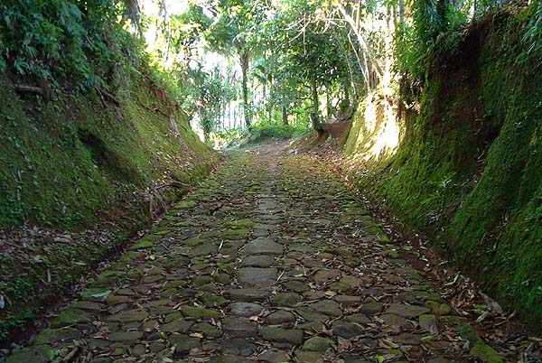
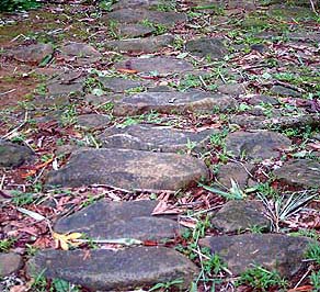
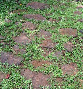
“We are entering Airai traditional village, called a-Irrai." Walter guides us into the village: "The central village of Airai has four pathways leading out to the east, to the west, one to the north and one to the south." These causeways are a defining feature of a Palauan village. “The stone paths lead to different locations within the village structure,” Tina explains, “and leading to different areas beyond. In Airai you can see how it radiates. Beyond the central location and then the clan homes and causeways, it is different from village to village, depending whether they are inland or close to ocean or whatever. Your geographic location would determine how the village is organized and built."
|
||
|
|
||
| "The pathway to the north is going to the traditional bathing area, the taro patch, and one of the main landing places over there," Walter says. "There used to be a canoe house over there at that landing place. "The pathway going to the west is leading to another of the landing places over there, and then on to the next village. The pathway going to the south is going to the waterfront of Airai: to Bairamelengel and then to Uchulangas, the main landing place."
|
|
|
|
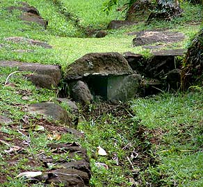
“The pathway gets wider at the end. And these are resting places. There is a little square on the side and the two uprights. This is a much wider area so you can sit down and rest on the side, while the center is still open for people to pass through. "The pathway going out to the north has what we call iliúd, the platform at the entrance of the village. That is where they have the platform square with four corners. That was when there were so many young men in those days, and there were some who patrolled the whole Airai Village boundary, like warriors."
|
|
|
|
|
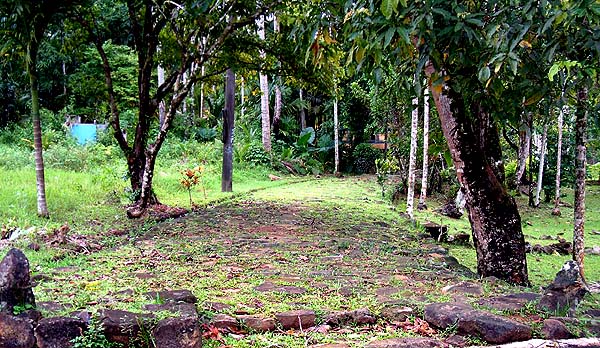
"This is the east entrance to the village,” Walter continues. “The stone pathway stops here. This is called the Bdelulacharengioi, and this is where the village proper ends. It doesn’t continue to out the next village or to the garden. It just stops over here, and then the rest is just a trail to go to the next village.”
|
||
|
|
||
|
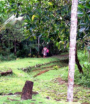
“This is the main pathway, people go back and forth on this. And in the old days, we didn’t have grass growing on it. In those days, you’d see only the stones, nothing green. That’s because in those days the rubak—the chiefs— each had portions of roads that they took care of. And there you would see them picking the weeds, with just a knife, and their kids too would be helping out. "Once they got it clean, they could say, ‘well, next time
we’ll just need to pick a little bit.’ And you’d hardly
see people littering, because the rubaks were always around here, and
people were really careful about that.”
|
|
|
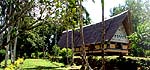
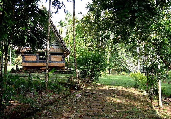
“Each village is different depending on the people and how they organize it,” Tina points out. “But normally a traditional clan village has a ‘zoning’ system that is designed so that people have access to the bathing areas, access to getting their food, access to taro patches, to gardens, to the channels where you go back to go out fishing. "It was also important for people to have access the center of the village—the focal point, the town square you might say—for meetings and village gatherings. "Accessibility was very important. The major focal point is the bai, and there was a series of bai there. The really elaborately decorated and built one is the council of chiefs’ bai, like the bai in Airai. And then there were a series of other bai that would built as a bai but they were not as fashionably decorated, because it is for the young men’s association. Women didn’t have a bai.”
|
| |
|
Interactive Map:
Houses of Airai Village: |
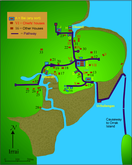
| 1. Tkar
|
10. Oiurrang |
19. Ikidel
|
28. Ilulk |
|
|
|||
|
“Most traditional villages are set up like this Airai Village” Walter says. “There is the main bai for the 10 chiefs of the village, and it is like the central part of the village. Everything is sort of revolving around the central bai. Then individual chiefs’ house platforms more or less circle around the chiefs’ bai, the hub of the village. They are distributed along the main stone pathways that go around the village—according to the numbers from 1 to 10."
|
|
|
|
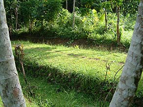
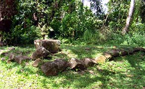
"The heads of the clan—or the head of the village—normally live close to the bai, to the center,” Kathy states, “ and they would have their own stone platforms; and then the next, and the next, around, and it goes on. "The high clan usually has a pretty prominent location within the village setting, but it would not be true to say that the lowest or the tenth clan would be living at the far end. But you could tell if you go to the village, there would be a bai and one of the permanent structures next to it or close to it would be the head, the chief of the village."
|
|
|
|
|
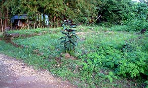
“In traditional Palau the land is mostly clan land,” Tina explains, “and people are living on their own clan land. The clan or chief of the clan is entrusted with looking after the clan land. "Then there was also land that belongs to the public, under the trusteeship of the council of chiefs, and the traditional head is the person who would oversee that. That public land is for the community, and as an individual—I could be from a lower rank or whatever—I have access to go there and garden. I have access to go there and use the land to ensure my existence, that my living is maintained. I could use it to cut wood for my house or whatever."
|
||
|
|
||
|
|
“Land in the village is matrilineal, but the chief of a clan is the trustee. Let’s say you are a member of the clan and you pass away. Normally the senior female members of a clan and a chief, they decide. It is the women who say ‘okay, this land is going to be yours,’ The women are saying, ‘okay this piece of land we give your daughters,’ and then they give them a piece of taro patch, and then clan land to live on or something. But again, but the chief is the trustee for the land of that clan, but he cannot just give it away. "Of course the today we find that system changing, with individual ownership that has altered the land tenure system to some extent.”
|
|
|
|
|
This association of village structure with the location of clan lands and homes brings us to a discussion of Palauan houses.
|
||
|
|
||
|
|
|
|
|
|

|
| Airai Home | Map Library | Site Map | Pacific Worlds Home |
|
|
|
|

|
 |
|
|
|||
| Copyright 2003 Pacific Worlds & Associates • Usage Policy • Webmaster |
|||