 |
 |
 |
|||||
|
|
|
|
|
|
|
|
|
|
|
|||||||
| |
|
|
|
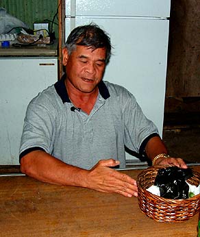
“My understanding from my old folks, who were working for the military, was that this was all an operation of the Central Intelligence Agency, the CIA,” Ben says, “and I think at that time, back in the 50’s, they were planning to train a lot of the South Koreans and some Chinese for guerilla warfare back in either China or Korea. "
|
||
| |
||
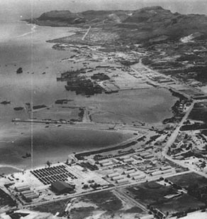
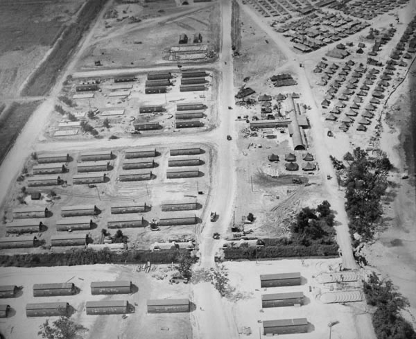
“Those were the years of the CIA operations out here, from the ‘50s,” Scott confirms. “Nobody here knows much about it, but the islands were being used as training bases for covert operations by Chinese nationals, and they were also operating in Tibet. The NTTU, Naval Technical Training Unit, was the front for the CIA. “The problem was that about half of the village at that time was covered by a military installation and so they lived side by side with this military base--and not very happily. There were major modifications. There was a big fuel tank farm to the south. They dug out big soil revetments and they built oil and gasoline storage tanks. "If you look at the old air photos from the '50s and '60s, you’ll still see them there. There may still be a few out there."
|
|
|
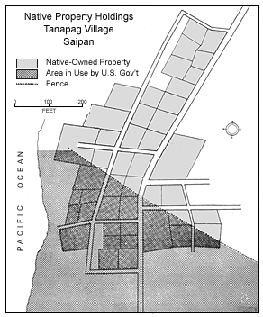
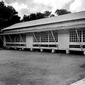
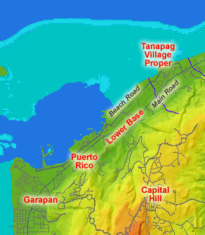
“The military put up a barbed-wire fence, “ Ben adds, “and restricted local people from entering the Lower Base. The military installation extended from this village almost to Puerto Rico, and there were fenced areas to keep local people from getting into the compound. There were a lot of quonset huts for living quarters for the personnel. "They had a very nice beach: they had a diving board, a sliding board, and a pontoon. And we were hanging on the other side of the barbed wire, just admiring all these things that are happening, but we weren't allowed in. There were constantly military police patrolling around the area. It was very highly classified, and we were not allowed to co-mingle or to join those folks, the military personnel in that village."
|
“The NTTU used the village to house military personnel,” Juan remarks. “There used to be barbed wire next to the church. There was barbed wire from about a hundred yards south of the church all the way to the main highway. The barbed wire ran about 30 feet out into the water. "And it was off limits for all the residents to go in. You had to be an employee. You couldn't just get a pass just for the sake of getting a pass, you had to be employed to get a pass. And the pass was only privileged from 7:30 to 4:30, unless authorized." “They had a very elaborate system there,” Ben explains. “They had a huge mess hall, and a huge repair shop for their vehicles. I remember when they were getting ready to leave Saipan, these vehicles just littered the island. Just find gasoline and oil and a live battery, start one, and you could take it home."
|
|
|
|
|
|
“Down here in Lower Base there were American soldiers,” says Jesus, “and up there at Capitol Hill. Up near San Roque was a place called Magazine, and lots of quonset huts were there. The American soldiers stayed there, and some of them stayed up in Capitol Hill, and others were down in Lower Base. "We were working for the military here at Lower Base, but most of my job took me down to Micro Beach. The Navy were stationed down there by the Micro Beach where they had the water supply and the machine shop. That’s where I worked with the government, and I learned how to weld. They didn’t really teach me to do welding, but because I wanted to learn I picked up that trade. Almost half of the able men went down to work for the military. The others farmed their land. Those who did not want to work for the government would go to the farm."
|
||
|
|
||
"During the Navy time, when I was a student at San Roque Elementary School, there was no transportation," Juan says, "so we had to walk. Every day, morning and evening. We have to wake up at 5:00 in the morning and start getting ready, and we started walking up to San Roque to go to school. And after school we walked back home. For six years, during the Navy time, there was no government transportation provided to students. "The English language spread because of the Navy influence. When the Navy and the NTTU first started their administration of the island, less than a handful of people here could barely manage to speak even a little bit of American."
|
|
|
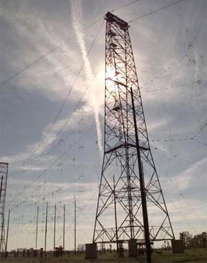
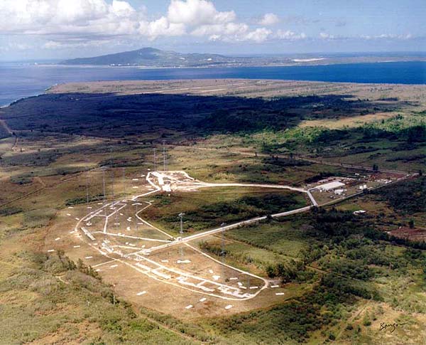
"As a matter of fact there was a joke: an American guy says, 'I want to marry your wife.' And this Chamorro worker in the government says, 'Yes, sir!' That’s how the military—the NTTU or CIA—trained us: 'Yes, sir!' They taught these people this 'Yes, sir!' So the islanders worked, but worked without questioning their superiors as to what they were doing. “There were 75- to 120-foot communication antennae right in the heart of the village. They were transmitter antennae. I don’t know if it was the Voice of America, but that was the NTTU. It was the NTTU who built the four antennae, and of course, like I said, we don’t know what they were doing. They would just come and repair them and do what they needed to do. But the antenna were not fenced in or anything; they were really inside the village. The antennae were outside of the fence, outside the ‘off limits’ area. They were in the heart of the village."
|
|
|
|
|
“Voice of America was here; I vividly remember,” Ben says, “There were four huge antennas and they were so huge, I was scared to even look at them. Because you would be looking up, leaning back, and you’re ready to fall on your back. I never attempted to climb them, they were that tall. In my mind, maybe I’m scared of heights, but I just knew that it would be too high, and if I climbed it and fell down, it definitely would be my last day, so I never attempted it. Those towers were right in the center of Tanapag. Right smack in the village."
|
||
|
|
||
“Back in 1968 Typhoon Jean damaged the entire island and one of the antennae fell. And when it fell, it fell toward the church. And there were a lot of people inside the church. And then they thought a bomb had exploded, because this antenna fell right toward the church, and guess what? The tip of the antenna landed only a foot and a half from the building. And that thing just came down like this, with a loud noise, and everybody thought that the whole church exploded.” "I left the village and I went abroad to get educated, and when I came back there were no more antennas, so I don’t know what happened. Perhaps they were declared unsafe or unstable, and they took them down. There are no remains in the village. Even the base, the base was built on block, I think it’s about 10 feet by 10 feet, and then where the foot of the tower was built on, I think it was 5 feet by 5 feet. And these blocks are gone now. They’re not there."
|
|
|
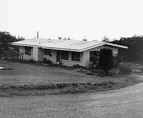
“About 1956 we move up to Capitol Hill,” Rosa says, “because that’s the time that the Navy--all of the NTTU family--went out of the island. I followed my ‘nieces,’ the family I was working for. I was working for Mr. Bacchus. He was a chief engineer for the Four Winds (the ship for the NTTU). The captain of the ship was Captain Whitman, and Chief Engineer was Mr. Bacchus. They had four kids, and I moved with them up there. The house number was 1365. The captain's was 1364." “It was the CIA that moved up to Capitol Hill,” Ben clarifies. “They have a very nice place up there and so when the Navy left, they moved a lot of their people up to Capitol Hill to continue their work.” “Capitol Hill was their place,” Scott elaborates. “Up until ‘62, you couldn’t even go up there. That was off limits."
|
“A fellow that was looking for Amelia Earhart came out here around 1960 or ‘61—he got security clearance out of Washington (which was needed to come to Saipan) and they allowed him to come out and look around. And then one day he was summoned by the Naval commander, so they put him in a jeep and they drove up Capitol Hill. "And suddenly he was in this little suburb in the United States: nice neat concrete houses and sidewalks and everything is paved, and there was a commissary up there and a basketball court and a post office and a bar. It was a little self-contained American community, and he had been on the island for weeks and didn’t even know it existed. So it was a weird little place up there."
|
|
|
|
|
“The Navy and the NTTU were replaced by the Trust Territory government,” Juan says. “That transition started taking place in 1962. I remember this because the school used to be run by the Navy, and then by the time I got there it was transferred over to the Municipal Government.” This change of administration was part of a series of events that would have considerable impact on the people of Tanapag and the evolution of a new form of governance in the Northern Mariana Islands.
|
||
|
|
||
|
|
|
|
|
|

|
| Tanapag Home | Map Library | Site Map | Pacific Worlds Home |
|
|
|
|

|
|
|
|||
| Copyright 2003 Pacific Worlds & Associates • Usage Policy • Webmaster |
|||
