 |
 |
 |
 |
||||
|
|
|
|
|
|
|
|
|
|
|
|||||||
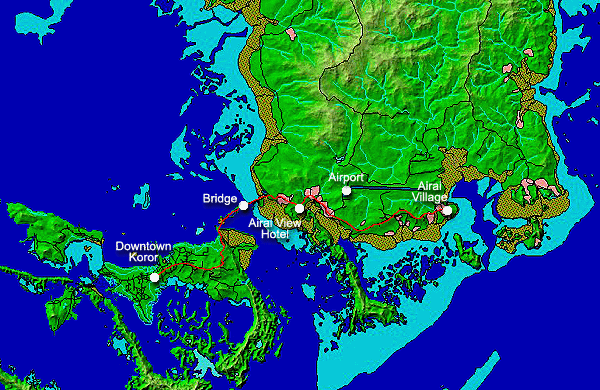
| Getting to Airai | |
|
|
|
|
|
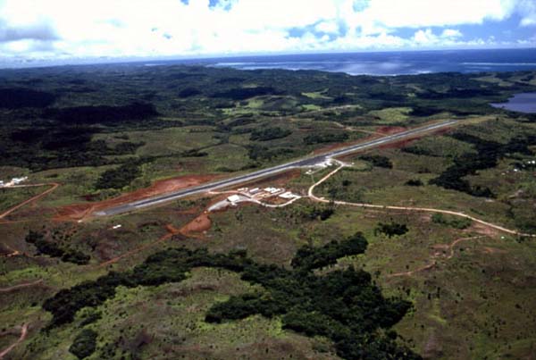
If you are flying into Palau you actually land right in the State of Airai. The airport here serves most of Palau. But this does not give you a sense of Airai's relative location to Koror State, the population center of Palau. Within Palau's unique geography, the capital city and center of power, Koror, is located on a handful of small islands, while the nearby large island of Babeldaob remains largely rural and, at this writing, difficult to reach (the new Palau Compact Road will change that shortly). So let us start our journey in Koror state, where most visitors will reside.
|
||
|
|
||
Koror state occupies a number of small islands centrally located in the Palau archipelago. It was traditionally a highly prominent village, but acended to status as capital of Palau after the first extended contact with Westerners took place here in the late 1700s. Koror was developed into a small city during the Japanese colonial period, 1917-1945, and was known as "Little Tokyo."
|
|
|
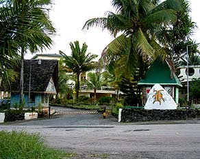
While some remnants of the Japanese occupation still stand, the city was extensively bombed during the Second World War. It has since been rebuilt, but old timers say it is nothing like its former glory under the Japanese. Today Koror is a fairly busy town, full of modern amenities and serving the important tourist population that brings so much revenue to the islands.
|
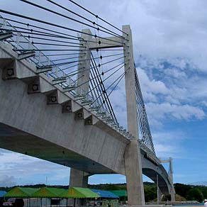
Departing from Koror downtown, one winds up past the old entry gates and along a narrow twisty road that leads to the Japan-Palau Friendship Bridge. This bridge connects Koror State to the island of Babeldaob. Consequently, the previous bridge built on this site was called the "K-B bridge," and this one is also generally referred to by that name. The original bridge was built in the 1970s but collapsed in 1996. A temporary bridge connected the two islands until the new bridge opened in 2002. Causeways—raised roadways across shallow channels—that reach towards the bridge were built by the Japanese.
|
|
| |
|
|
|
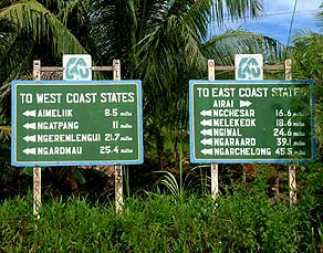
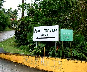
On the other side of the bridge, the roads around Babeldaob begin. In 2002 these roads were largely unpaved, although pavement reached all the way to Airai Village itself (perhaps a 20 minute drive). Going West, the road rapidly turned to dirt and gravel, unpassable by ordinary vehicles. Going East, the road is paved as far as Airai Village. Note that according to these signs, all the East Coast states other than Airai must be reached by first taking the West road. Only Airai State is served by the Eastern road.
|
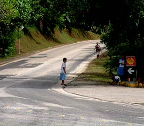
A new road around Babeldaob, called the Palau Compact Road (because it was being built under agreements in the Compact under which Palau negotiated its independent status from the U.S.), opened in 2007, after this project was done. It opened up Babeldoab to easy transportation. But until then, the inner reaches of Babeldaob were difficult to reach except by boat, and even that depended on the tides. In this picture, we are turning East at the signs above, and starting in the direction of Airai Village.
|
|
|
About five minutes later the Airai View Hotel pops up on the right (ocean) side of the road. This very attractive hotel perches on a hill overlooking the very long limestone ridge that runs out into the lagoon. Out on this ridge is Metukerabisech, one of several sites in Airai State where the Yapese quarried their stone money. The hotel also signifies the expansion of development out of Koror State into neighboring Airai State.
|
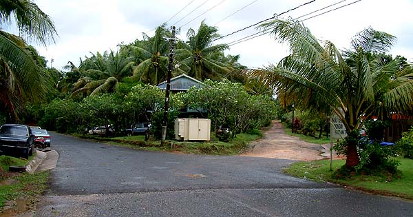
Further down the road, the entrance to the Palau International Airport appears at the left. The airport was originally begun by the Japanese, but was not completed until well after the Second World War, by the Americans. Atop the hill is also the Palau National Communications Center (PNCC), which handles all telephone and internet service in Palau. Beyond these two facilities, this road continues deep into the center of Airai State. The sign on the right, however, points us towards the bai at Airai. |
|
|
|
|
|
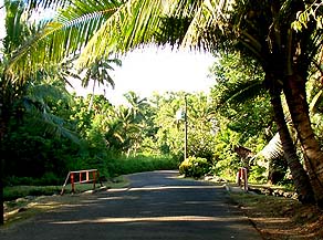
The road continues to wind it's way above the coast, passing Airai Elementary School, then later the ruins of Japanese communications center that was bombed out in WWII. Just past these, a dirt road splits off to the right and a number of houses come into view. This settlement is the "new" village of Airai, originally settled in the 1960s by people from Oikull and Ngchesechang villages.
|
||
|
|
||
When the road starts down the hill from here, we are entering the outskirts of Airai Village proper. At the bottom of the hill a bridge over the stream marks the location of Diberdii, one of the traditional landing places for Airai Village, connected to the lagoon by a "water trail" through the mangrove. This is one of two traditional landing places that served peoples from the rival forces on either side of Airai—Oreor (main village of what is now Koror State) and Melekeok. Airai's position between these two earned it the name Tóilbeluu, or "place where you pass through."
|
|
|
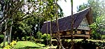
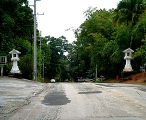
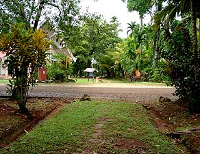
Up around the bend from here, we cross one of the traditional stone pathways that define traditional Palauan villages. Four such pathways extend out from the center of the village. To our left, this pathway leads to the center of the traditional village; to the right it goes past a modern "community" bai and down to the main dock of Airai. Taking the road to the very end deposits us at the end of the Eastern pathway, today the entrance to the village.
|
|
|
|
|
Now you are ready to arrive in Airai Village.
|
||
|
|
||
|
|
|
|
|
|

|
| Airai Home | Map Library | Site Map | Pacific Worlds Home |
|
|
|
|

|
 |
|
|
|||
| Copyright 2003 Pacific Worlds & Associates • Usage Policy • Webmaster |
|||