 |
 |
 |
|||||
|
|
|
|
|
|
|
|
|
|
|
|||||||
| Getting to Kawaihae | |
|
|
|
|

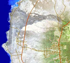
Visitors to Kawaihae will mostly fly into Kona International Airport at Keahole. Kailua-Kona is the major urban center on the West coast of Hawai‘i island. The airport is built on a tongue of lava stretching into the sea from Hualalai volcano, which rises up behind Kona and creates an afternoon cloud cover for which Kona is renowned. Keahole—ke ahole—is the name of the Hawaiian flagfish.
|
||
| |
||
"In 1810, Kamehameha moved his aquaculture center from Keahole to Kiholo," Billy Paris remarks, "because the 1801 flow had filled in the great pond, the Paiea Pond that our new airport there sits upon. That was a fishpond three-and-a-half miles in length, and that was completely filled in by the 1801 flow." The name "Kona" refers to this portion of the Big Island, now two districts (North and South Kona), and has the same root meaning as the word "tonga" in other Polynesian languages. It is the "south" and in this case leeward portion of the island. Kailua is the town, and was a major seat of power for the early Hawaiian monarchy.
|
|
|
From Kailua-Kona, there are now two roads north to Kawaihae: the mauka (upland) road via Waimea, and the makai (coastal) road. The coastal road is named for Queen Ka‘ahumanu, the favored wife of Kamehameha I. The upper highway or "Belt Road" is the Mamalahoa Highway. This name refers to a particular company of Kamehameha's warriors, and also to his "law of the splintered paddle," which guaranteed the safety of the highways to all. Because of the dramatic differences in elevation, the choice of roads will provide very different experiences. Both roads transect a largely unpopulated portion of the Big Island. They start out on the shield of the Hualalai volcano. Here the Belt Road will pass the distinctive cone of Pu‘u Wa‘awa‘a, and the nearby Pu‘u Anahulu.
|
|
|
|
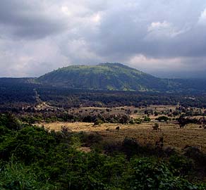
This land has been ranching country for a long time. In her book ‘Olelo No‘eau, Mary Pukui notes the saying, "E ho‘i na keiki oki uaua o na pali," or "Home go the very tough lads of the hills." She adds, "these lads of the hill were the cowboys of Pu‘uwa‘awa‘a and Pu‘uanahulu, who were well known for their endurance" (‘Olelo N o‘eau #288). "My mother’s family had the lease on the entire lands of Pu‘u Anahulu and Pu‘u Wa‘awa‘a, six hundred and six acres," Billy says. "That was quite a bit of shoreline from the Kopulea boundary all the way to Kapalauau, which is just on the south side of Anaeho‘omalu Bay.The land of Pu‘u Anahulu is the northernmost land in North Kona, and it meets the South Kohola boundary just before you get to Waikoloa complex."
|
|
|
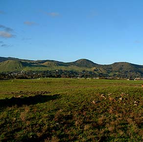
"Most of the cattle were raised above Kiholo, where we shipped the cattle. On the south side of the bay we had a little beach there and we’d swim the cattle out from there. My father would take feeder cattle to Pu‘u Wa‘awa‘a. Over the top of Hualalai, we’d pick up bulls on the top of the mountain from the Pu‘u Wa‘awa‘a cowboys, and bring them back to Kona over the top of the mountain. My first trip, I was five-and-a-half years old." The Belt Road will bring you into the town of Waimea, also known as Kamuela, "Samuel." Some say the name comes from Samuel Spencer, a former postmaster here. Others say it is named after Samuel Parker, son of the founder of Parker Ranch. Parker Ranch, an enormous enterprise, owns most of the land up here, and has its headquarters in Waimea. To continue to Kawaihae, one must turn left in the center of Waimea and head downhill. The descent is 2670 feet (814 meters).
|
|
|
|
|
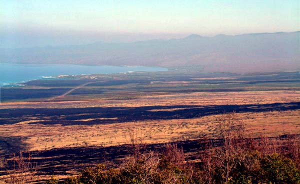
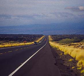
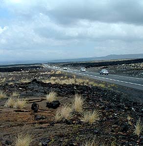
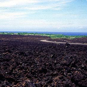
While the Belt Road will continue across the cooler, greener ranch lands of the upper elevations, the Queen Ka‘ahumanu highway on the coast is a dramatic contrast. Here on the hotter, drier coast, the many lava flows of Mauna Loa and Hualalai stand out in their rawness. On passes through alternating bands of different colored lavas, both pahoehoe and a‘a flows.
|
||
|
|
||
Once there were fishing hamlets along the coast. Hannah Springer remarks, "With the overthrow of the Monarchy [in 1893] comes the Land Act of the 1890s, which encouraged Hawaiians to engage in land ownership. Homesteads were established near to where the Ranch at Pu‘uwa‘awa‘a is situated. So we have people still maintaining their cultural geography, but living in locales that perhaps they were not so fixed to before." "Urban centers were attracting people away from the fishing hamlets, and finally with the 1946 tsunami, the last of the old folks returned to the coastline. World War II was happening, the young men that were of that age and of that inclination were going off to war. And so we see, finally, an abandonment of the fishing hamlets by Hawaiians on the north Kona Coast in the late 1940s." |
|
|
"But, fast-forward to now, and you have burgeoning subdivision and resort developments in North Kona." A series of large, self-contained resorts now mark the coast going towards Kawaihae. These have been carved out of the lava fields and sit like oases in this otherwise barren landscape. At one of these, the Mauna Lani resort at Kalahuipua‘a, an extensive historical complex is maintained that includes six fishponds. There is also a petroglyph field, ancient cave shelters, and the Keawanui landing where it is said Kamehameha maintained a small village. Along this coastal road, the landscape will get drier when approaching Kawaihae, the driest area in all the Hawaiian islands. |
|
|
|
|
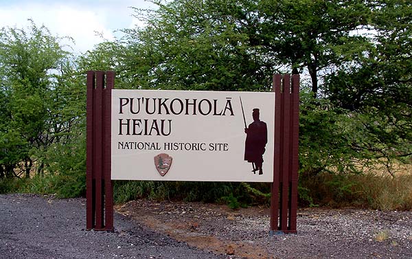
Either way you come, you will not know for certain that you have entered the first of the two Kawaihae ahupua‘a, until you reach the junction where the road coming down from Waimea meets the Queen Ka‘ahumanu Highway. From this point, you continue down towards the coast. The road is now the Akoni Pule Highway, which continues up and around the Kohala coast. Not far below this junction is the turn-off for Pu‘u Kohola heiau, the major Hawaiian cultural feature of Kawaihae. At this point, you have entered the traditional settled area.
|
||
|
|
||
|
|
|
|
|
|

|
| Kawaihae Home | Map Library | Site Map | Hawaiian Islands Home | Pacific Worlds Home |
|
|
|
|
|
|
|


|
|
|||
| Copyright 2006 Pacific Worlds & Associates • Usage Policy • Webmaster |
|||