 |
 |
 |
|||||
|
|
|
|
|
|
|
|
|
|
|
|||||||
|
|
|
|
|
|
“A lot of the Hawaiian zone names identified by [Hawaiian historians] Malo and Kamakau were described for places like Ka‘u," Sam explains, "which is the opposite side of the island, and includes a different slope going from Kalae all the way up to the kua mauna of Mauna Loa. So it’s really hard to apply some of those to the Kohala mountains. "What is clear though is that almost anywhere you went, you could talk about the wao kanaka, the zone where the human beings occupied; and the wao akua above it, where it was largely the god’s realm. And the wao ma‘ukele, the wet forest zone.”
|
||
|
|
||
“If you looked at some of the lower zone names for Ka‘u that are applied in Malo and Kamakau, they talk about the zone where the ‘ilima grows and the zone where various other things happen. You could probably find those same zones in the Kohala mountains and logically apply them there. "But whether or not the people of Kohala had their own names for the different zones going up the mountainside, that would be a really hard call. They probably had a regional, independently derived set of names. Maybe it overlapped with many of the others, but maybe not.”
|
|
|
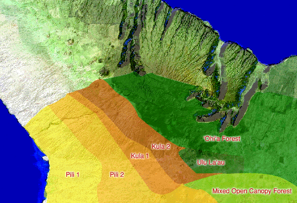
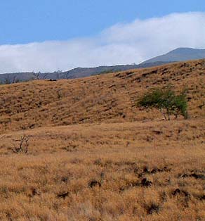
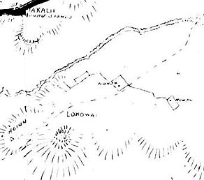
In her study of vegetation zones in Kawaihae, Holly McEldowny (1983) used Mahele-period land records and found that Hawaiians identified several distinct zones. These include two low-elevation pili zones, mid-elevation kula zones, and forest. The following discussion draws on her work. Pili is generally equated with the grass (scientifically identified as Heteropogon contortus) that was used as the thatching material for Hawaiian structures. But the term pili, it appears, may have been a generalized term for grasslands, or a prominent grass component. "The term ‘pili’ was applied to these grasslands because the resident Hawaiians giving boundary testimony in Kohala between 1865 and 1873 consistently and clearly distinguished between a lowland area called pili and the upland cultivated region” (McEldowny, 1983: 416).
|
|
|
|
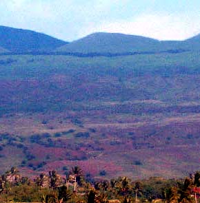
“Throughout the early historic period, descriptions of barren, stony and dried landscape overshadow what might have been said about the composition of this withered and scanty plant community,” McEldowny notes (1983: 416). At the same time, many early historic visitors pointed out groves of trees in this zone, including coconuts, lauhala (pandanus), loulu palm, kou, and milo at different points along the coast of South Kohala.
|
||
|
|
||
“Documented use of the pili lands primarily centers around the scattered coastal settlements," McEldowny writes. "Descriptions generally stress contrasts between the small dispersed coastal populations, engaged primarily in fishing, and larger inland populations with their productive plantations.” Some cultivation clearly took place in the lowland zones, but behind these coastal settlements was the “untended and uncultivated” grasslands. One Waikoloa court case in 1867 spoke of “wild birds and pili grass” as the main economic products of these lands before cattle became dominant. It is also possible these grasslands were burned periodically to increase the abundance and ease the collection of thatching materials. (McEldowny, 1983: 417-8).
|
|
|
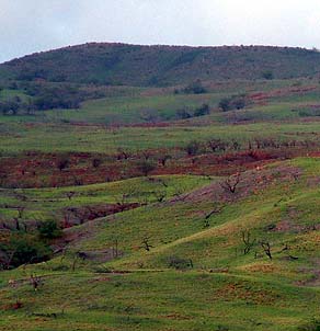
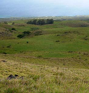
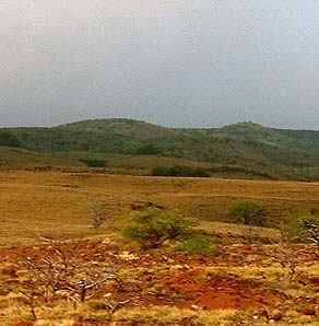
The upper boundary of the pili lands seems to be the lower boundary of the cultivated lands of Kawaihae Uka. Kula lies between the drier pili lands to seaward, and the forested lands higher up the mountain. McEldowny’s division of these cultivated kula lands into two zones reflects the degree to which the land becomes greener with higher elevations. Kula lands represent the major inland expanse of agricultural lands in Kawaihae. Kula is a predominantly open vegetation type used for cultivation. Both types of kula lands were predominantly open grasslands with unevenly distributed trees and shrubs.The 1884 legal definition poses kula as lands not used for wet taro cultivation.
|
|
|
|
|
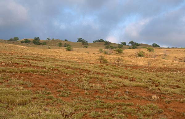
“Kula lands would be kind of mid-slope,” Sam explains. “That the whole upland field zone would have been termed kula, because kula is typically thought of as an upland, agriculturally developed zone. Below that, you would have the apa‘a and the other lowland dry zones, where ‘ilima grows and other things like that. The name apa‘a has nothing to do with ‘ilima, but the dictionary talks about the apa‘a where the ‘ilima and grasses grow. And the fact that the wind of Kohala is the apa‘apa‘a suggests that the apa‘a zone probably was over there. A windswept, grassy zone.”
|
||
| |
||
Agricultural plots are generally described in the historical record as “scattered” and “here and there.” The agricultural features described included the full range of Hawaiian crop species (such as taro, sugar cane, sweet potatoes, bananas, arrowroot) and historically introduced crops including Irish potatoes, onions, corn, etc. Visitors described interspersed “plantations”; “numerous acres of cleared upland ground”; “some fields of upland taro”; “the green taro patches on the plains and hillsides’: hedges”; and “broken squares of trees.” (McEldowny, 1983: 420).
|
|
|
Vegetation included alternate plots of shrubbery, grass, flowering bushes, and wild vines, hillsides partly cultivated and partly covered with grass. That these kula lands often needed to lie fallow for years between crops, probably accounts for the descriptions of these lands as patchy. Features include various types of Hawaiian land divisions and irrigation ditches: ko‘ele, ‘auwai, kuaiwi, iwi ‘aina, kihapai, and mala, in addition to several residential features. ‘Auwai (irrigation ditches) are recorded as boundaries on land claims as high as 4,000 feet in Kawaihae 1.
|
|
|
|
Above the kula is the forest. “The summit is over 6,000 feet.” Sam says, “and the forest starts maybe around 4,000 or so. For folks on the Kawaihae side it would be the wao, the wao akua and the ma‘ukele, the wet forest zone above the agricultural fields.”
|
||
|
|
||
|
|
|
|
|
|

|
| Kawaihae Home | Map Library | Site Map | Hawaiian Islands Home | Pacific Worlds Home |
|
|
|
|
|
|
|


|
|
|||
| Copyright 2006 Pacific Worlds & Associates • Usage Policy • Webmaster |
|||